Thursday, May 9, 2013

Croatia's Coastal Landscape

        Croatia is surrounded by multiple coastlines, however the most popular and frequently visited is the Dalmatia coastline. Along this part of Croatia, visitors can see some of the wide ranges of landscapes that the country has to offer. As well, tourists can come in order to see the immense flora and fauna that the country takes pride in.
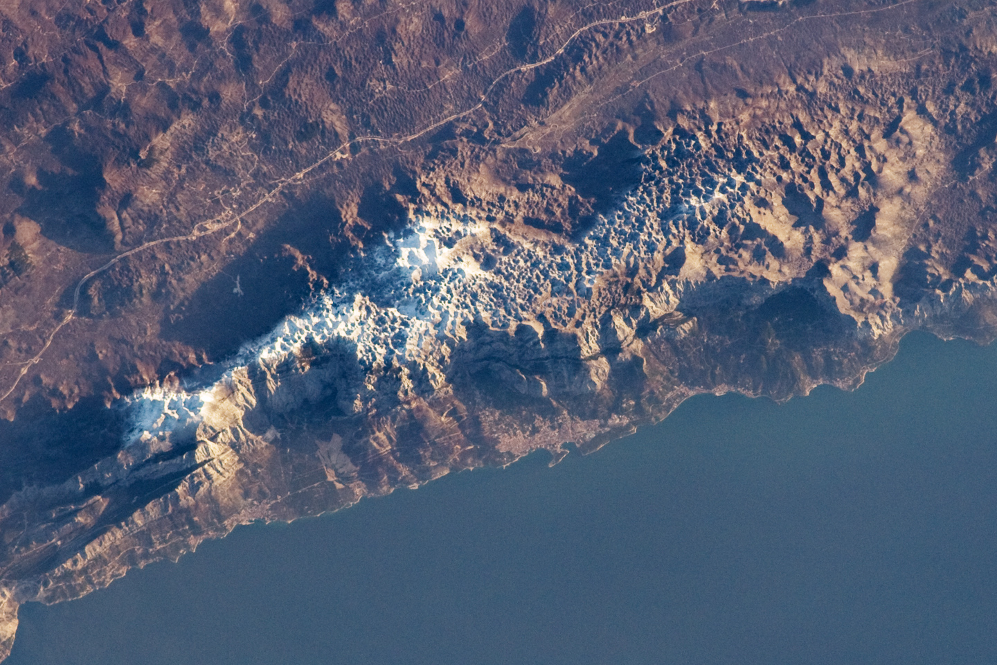
       The area of Dalmatia is formed mostly by the mountains that make up the Dinaric Alps, and this causes a unique spin on the not so typical beach. The coastline of Dalmatia lies pretty much right on the backside of the mountains. Therefore, there is not very much room for an actual sand beach. However, if you were to remove the real-estate that has come to inhabit the beach you would see that there would be a multitude of depositional and erosional landforms. Depositional landforms are those that are formed from the breakdown of weathered, and eroded surface materials. Where as, a erosional landform is one that results from the breakdown or removal of rock or sediment. 
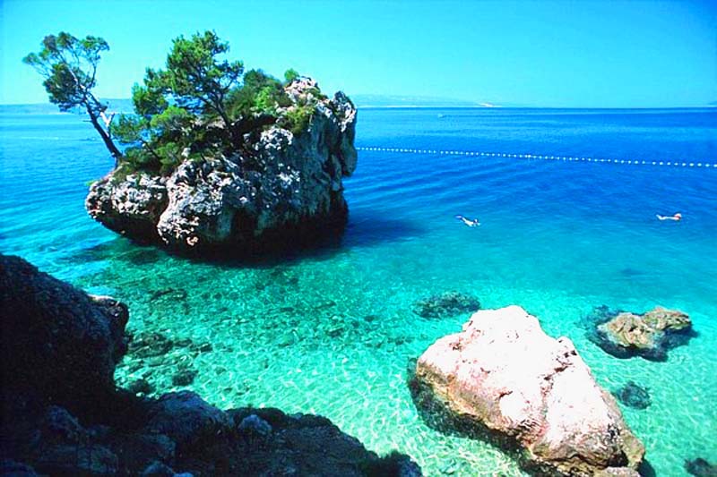
In the above picture you can see some erosion from past storms, and well as an attempt at a depositional beach.

      Within the oceanic coastline it self (and also seen in the picture above) one can easily see the presence of multiple coral reefs. A coral reef is a biological landform, and they can come in multiple shapes and sizes. The ones typically seen in Croatia are the similar to an Atoll coral reef. This simply means that the reef spreads in a circular shape, rather than building upwards. 

      Throughout the country, along the coastlines, many sea stacks can also be seen. A sea stack is typically a landform that consists of a vertical rock that is fairly steep, and it lies near or in the ocean. These sea stacks can also be referred to as sea stumps, and are known to house some foliage on top, and make great diving cliffs. An example of a sea stack can be seen in the photo below. 


Citations:

Photos:
http://www.awams.com/resources/images/locationImages/dalmatia.jpg
http://images.interchalet.com/teaser/dalmatien_ferienhaus.jpg
http://www.mytripolog.com/wp-content/uploads/2012/07/Dalmatia-azule-blue-water-Croatia.jpg

Websites:
"Events in the Heart of the Adriatic." Dalmatia. N.p., n.d. Web. 09 May 2013. <http://www.dalmatia.hr/>.

"Dalmatia and Dalmatian Coast Travel & Holiday Guide.Find Info about Accommodation, Festivals, Things to Do and Travelers Tips." Dalmatia, Croatia Travel Information. Places, Accommodation, Activities. N.p., n.d. Web. 09 May 2013. <http://www.dalmatianet.com/>.

The Independent. Independent Digital News and Media, n.d. Web. 09 May 2013. <http://www.independent.co.uk/travel/europe/croatia-the-coast-with-the-most-7973151.html>.

Thursday, April 18, 2013

Croatia's Climate

       The Republic of Croatia is known to be geographically diverse. This means that throughout the country there are many varying landscapes such as flat plains, low mountains, and highlands. Since there are multiple forms of landscapes across the country of Croatia this means that their climate also varies as the landscape shifts. 

       Croatia is located in Southeastern Europe and borders the Adriatic Sea, therefore there is a large portion of the country that lies on a coastline. During the summers the area along the coastline is known to have extremely dry Mediterranean weather. However, in the winters the coastline can get a bit chilly, but never really goes beneath five degrees Celsius. As well, the winters along the coastline can get pretty damp. It is not unheard of for the weather along the coast to go beneath five degrees celsius, for example in 2009 and 2010 there was slight snowfall near Dalmatia. 

Above picture is of winter 2009 in Croatia

          When it comes to spring and summer in Croatia the weather consists of very dry continental occurrences, and temperatures usually average a high of thirty degrees Celsius. While these areas are consistently warm, rough winds can sweep through the coastline during the colder months and well into spring. However, during the summer there are mostly sunny days, and the sunniest parts of the country do lie on the coastline, and include the outer islands of Hvar and Korcula. 

The above picture is of the Croatian coastline on one of the hottest days of the summer. Wind sweeping through the tree's can still be seen even on a hot day. 
             In the low mountains of Croatia the temperature is primarily cold with multiple snow drifts throughout the year. Some of the coldest area's across the country are located in Lika, and Gorski Kotar. These areas reach well into the elevation of about 1,200 meters, or 3,900 feet, and this is where the snowy forested climate is easily seen throughout the year. 
                While the country of Croatia does have multiple climates, there is consistency that can be seen throughout the country and throughout the change in seasons. This is true of most places! As seasons change, we are more likely to develop a weather patter due to our location on Earth. 


Citations: 
Pictures: 
1. http://www.find-croatia.com/beaches-croatia/omis-beach1.htm
2. http://images.smh.com.au/2012/02/04/2937321/dh_snow_20120204120247994555-420x0.jpg

Sources: 
1. "Visit Croatia - Info for Visitors - Weather & Climate in Croatia." Visit Croatia - Info for Visitors - Weather & Climate in Croatia. N.p., n.d. Web. 18 Apr. 2013.
2. "Croatia." Climate Information for. N.p., n.d. Web. 18 Apr. 2013. <http://www.climate-zone.com/climate/croatia/>.


Tuesday, March 12, 2013

Croatia's Hydrology- The Plitvice Lakes

            Croatia is home to one of the largest, and oldest national parks in Southeast Europe. Plitvice Lakes National Park is a perfect example of how hydrology is present in each country, and showcased in multiple forms. Hydrology is the study of the way water is moved and distributed. As well, the study of hydrology covers the quality of the water. One of the main ways water is stored is in lakes, streams, and oceans. There are in sixteen lakes that can be seen from the surface in the national park. However, the lakes cascade into small pools of water that create a waterfall effect. The lakes are a result of the pooling from several tiny rivers and subterranean karst rivers.  

               The lakes are separated into upper and lower lakes. They are separated by natural dams that are referred to as dams of travertine. Travertine is a form of limestone that is common in areas with natural springs or hot springs. Moss, algae, and bacteria commonly grow atop the dams thus creating the lush green image that can be seen throughout the national park. The water from the lakes mix with the limestone dams and create an environment that makes if easy for moss and algae to grow. With the flowing water the area is prone to lush flora and fauna. The roots of the multiple types of flora and fauna help to make permeability of the lakes possible. Permeability refers to how the pore spaces within the limestone allows for water to flow through them. Roots from various plants help to maintain permeability, thus why the national park water flow is extremely permeable. 
              The water within the lakes is considered gravity water. The water moves with gravity, and that is the reason why the flow of the water within the national park is so unique compared to others. The waterfall like flow of the lakes is known as overland flow. This is where water flows over the surface, and could potentially lead to a separate pooling of the water. 
               The lakes cover an area of two square kilometers and the altitude of the runoff descends over and area of eight kilometers. The last lake in the national park flows into the Korana River, which then flows through central Croatia. Overall, the flow of the water within the lakes is unique to the country of Croatia. The hydrology throughout this specific national park is important to the well being of the other water sources in the country. The Plitvice Lakes act as a meeting point for all watersheds that run throughout Croatia. When the water flow leaves this area it then continues to flow throughout the rest of the country. Therefore, it is important to have an understanding of the water flow within the lakes so that we can better understand the overall flow of water throughout Croatia. 


Citations:
(Pictures from top to bottom):
http://www.igniteme.co/wp-content/uploads/2012/11/4971312052_4b896ba198_o.jpg
http://topworldtourism.com/wp-content/uploads/2012/09/Plitvice-Lakes-National-Park-photo_6.jpg

(Sources):
"Beautiful Places to Visit." Beautiful Places to Visit. N.p., 24 Sept. 2012. Web. 12 Mar. 2013. <http://beautifulplacestovisit.com/lakes/plitvice-lakes-national-park-croatia/>.
"Plitvice Lakes National Park." - UNESCO World Heritage Centre. UNESCO, n.d. Web. 12 Mar. 2013. <http://whc.unesco.org/en/list/98>.

Monday, February 18, 2013

The Dinaric Alps of Croatia

          The Dinaric Alps span the Adriatic Sea and are known as the fifth most mountainous area in Europe. Located in Southern Europe the mountain range spans across at least six countries including Serbia, Croatia, Slovenia, and Albania. The high peaks of the range are made primarily out of sedimentary rocks formed by oceans and waters that previously covered the area. The sedimentary materials known to be found in the mountains include dolomite, limestone, and sand. 
              About fifty to one-hundred million years ago during the Alpine earth movements there were an expansive amount of lateral pressures that caused a folding of the rocks to occur. Folding is a form of diastrophism, by which a mountain is created due to the folding of layers on the upper parts of Earths crusts. Within this motion the rocks were thrust upward and formed an arc shape around the northeast. 

              In Croatia the highest peak of the mountain range (portion in Croatia) is known as Dinara. This peak being the highest peak in Croatia is known to be in the shape of a human head. The peak is named after an ancient tribe that was believed to live on the back side of the slope. 
                When looking at the mountains themselves one can see a large amount of anticlines, which are folds in an upward direction that house their oldest materials in their core. As well, a person could easily see quite a bito f hogbacks located throughout the mountain range. Since the mountain range was formed through the process of folding the presence of horsts and grabens is quite minimal. However, in a few pictures of the mountain range one could easily make out the presence of flatirons at the base of the mountain peaks. 
                The mountain subsides around Albania in order to make way for the water ways that are located in the area. Then later the Korab mountains begin the formation once again. The shape of the area here make it extremely hard for any species to exist in the range. For example, the high peak of Dinara in Croatia is home to one very specific type of rodent called the Balkan snow vole. This is also known as the "rat of Croatia" and is known to be endangered and near extinction. Overall, this area of Croatia is an element that thrives in tourism, but within it nothing much can sustain to thrive there. 
                The range is well preserved by law officials, and the help of wilderness preserves, and continues to be host to a large amount of visits from local families, as well as, tourists visiting the area. 


Citations: 
Pictures from top to bottom: 
http://kids.britannica.com/comptons/art-713/The-Dinaric-Alps-rising-from-the-Dalmatian-coast-at-Makarska

http://peakery.com/dinara/

http://earthobservatory.nasa.gov/IOTD/view.php?id=36849

Other citations: 
"Dinaric Alps." : Climbing, Hiking & Mountaineering : SummitPost. N.p., 06 Jan. 2006. Web. 18 Feb. 2013. <http://www.summitpost.org/dinaric-alps/155326>.
            
"Dinaric Alps". Encyclopædia Britannica. Encyclopædia Britannica Online.

Encyclopædia Britannica Inc., 2013. Web. 18 Feb. 2013

<http://www.britannica.com/EBchecked/topic/163795/Dinaric-Alps>.


Tuesday, January 29, 2013

Introduction

           Welcome to my blog for Physical Geography 1202! My names Marina Stambaugh, and for my blog I have decided to study and understand the geography of the country Croatia. 

           Croatia lies at the crossroads of Central Europe and the Mediterranean. The country is home to more than one thousand islands on the Adriatic Sea. As well, it has become the host of one of Europe's most beautiful National Parks called the Plitvice Lakes. 
             I chose to focus this semester on Croatia because it has always been a place that I have wanted to visit. The beautiful water, and the mountainous land has always peaked my interest in the country. Not only that, but the country is known to be one of the most interesting medieval cities since it was extremely well preserved. Over the course of the semester I hope to further my interest in the country, and have a better understanding of how the country became so unique. 
  
Citations:
Photos top to bottom
http://www.nationalgeographic.com/adventure/images/nov_05/croatia.jpg
http://park-plitvice.com/wp-content/uploads/3968164.jpg
http://www.map-of-croatia.co.uk/maps/Large-map-of-croatia-400.gif